 |
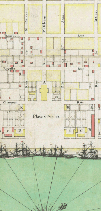
New Orleans, c. 1721 In 1718, mechanics and workers arrived in French Louisiana to clear the ground for the city of New Orleans. This hand-drawn map —the earliest known map of New Orleans—was created just three years later, probably by the French engineer who had drawn up the plan for the city. This detail shows the central city and plaza, including Bourbon Street, Rue Royale, and other streets now celebrated as landmarks of the French Quarter. The buildings colored red had already been built when the map was drawn; the buildings in yellow were still to be constructed. |