All maps ©Sterling Memorial Library Map
Collection. Map photographed by Mark Morosse.
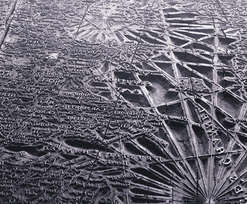
Woodcut block, 1700
Until the early 1500s, when copperplate etching first
came into use, maps printed in Europe were made from wooden planks carved in
relief. Woodcuts were still used regularly until the early 1800s, when
engraving became the standard; even hardwoods could not hold the fine detail
that became possible with metal plates. But wood did allow production of
multiple impressions. The raised surfaces were inked and the block pressed onto
paper in a hand printing press.
The map carved into this block is “A new map of
England and Wales.” The photo shows the Bristol Channel at lower center,
with Wales above and St. George’s Channel (leading to the Irish Sea) to the
right. (All labels are, of course, reversed.) At center right is a carving of a
ship at full sail.

