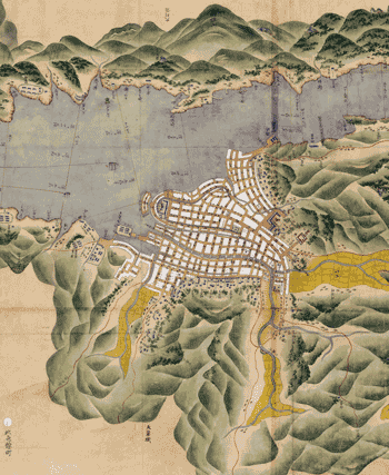
All maps ©Sterling Memorial Library Map
Collection.
Nagasaki, probably late 1800s
This is a section of a map that depicts the entire
Nagasaki harbor region, from the city of Nagasaki proper in the north to the
southern tip of the peninsula that protects the harbor. The detail pictured
here (oriented with west at top) shows the city, the surrounding mountains, and
even the bridges over the Urakami River, which flows due south through
Nagasaki.
This map, says map dealer Bill Reese '77, shows
“the very different forms of visualizing cartography that you often see in
non-Western maps,” especially in its depictions of mountains and other
relief detail. In the past two decades, historians have increasingly begun
studying maps as cultural objects.

