 |
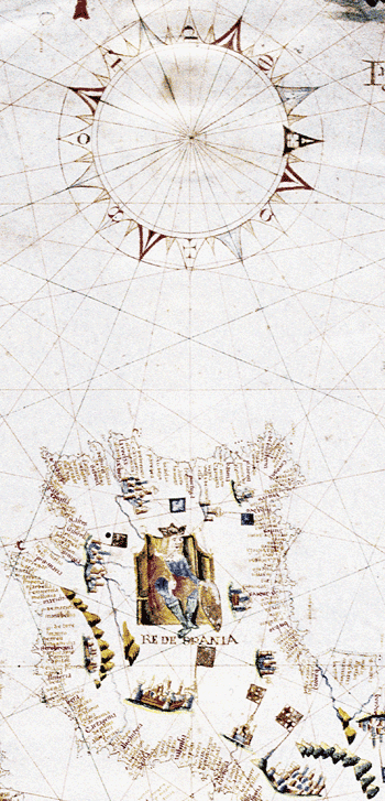
Portolan, Jacobo de Maiolo, 1553 Portolan charts were nautical maps of fourteenth- to sixteenth-century Europe, often owned by merchants: their technical and geographic information could mean the difference between a profitable voyage and a wreck. Portolans are crisscrossed by radiating “rhumb lines,” used as guides for charting a ship’s course, and their coasts are thick with the names of towns. The charts' accuracy and their reliance on the compass had a strong influence on European mapmaking. This detail is from a portolan of the Mediterranean on vellum. (It is positioned here with west at top.) At lower right is Spain, with a decorative portrait of the “Re [king] de Spania.” |