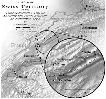
All maps ©Sterling Memorial Library Map
Collection. Cartography courtesy Stacey D. Maples/Yale Map
Collection.
Equipped with an itinerary by the editors of the Yale
Boswell Editions, Stacey Maples, GIS assistant in the Map Collection, created
four maps charting Boswell’s travels through German and Swiss territories
during 1764-65. For the map above (a detail of a work in progress), Maples
blended five different layers of radar data to create the “Swiss
shading” effect that shows the steep terrain.

