 |
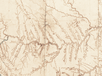
Clark drew detailed depictions of the rivers, the Missouri system in particular, on which the Corps traveled. “For the most part, this is not a map of the land—it’s a map of the waterways,” says Miles. “In this period before steam, before railroads, rivers were important as the way you traveled rapidly and transported lots of goods great distances. So in a sense, this is like the New York City subway map. It shows the routes of commerce and transportation.” |