 |
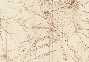
Clark placed the headwaters of the West’s major rivers within a single area only about 150 miles in diameter—an example of “wishful thinking,” says John Logan Allen. “Jefferson and others had hypothesized that there would be a core drainage area—a relatively small pyramidal height of land somewhere in the continental divide—and if you could control it, you'd be able to control the surrounding entire region economically and militarily.” Clark located this area in the central Rockies, a place he hadn’t visited personally and about which he had limited information from other reliable sources. “There are actually two core drainages, one in northwestern Wyoming and another in south central Colorado,” says Allen. “They’re about 600 miles apart, but Clark squeezed them both together.” |