 |
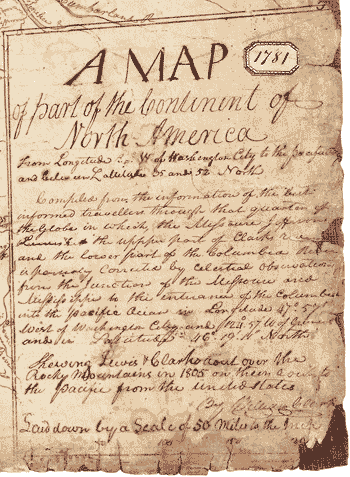
Clark completed his map in 1810. (The “1781” is an inventory number.) In this legend, he writes that the document was “compiled from the information of the best informed travellers through that quarter of the Globe.” Where the map was “[s]hewing Lewis & Clarks rout over the Rocky Mountains in 1805 on their rout to the pacific from the United States,” it was quite accurate. But in areas where the Corps did not journey and where Clark got little hard information from local people, accuracy broke down. |