 |
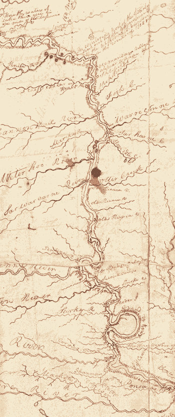
In its first year, the expedition reached the villages (shown as a group of dots to the north) of the Mandan and Hidatsa tribes, a thriving community of 4,500—more than were living in St. Louis or Washington, D.C., at the time. There, in a hastily built fort near present-day Bismarck, North Dakota, the Corps settled for the winter. (Clark’s cartography of the Missouri River here is highly detailed, down to the oxbow—the “Grand Detour”—to the south.) The map gives locations of many other Indian tribes. “One of Thomas Jefferson’s goals in commissioning this journey was to identify native people who were potential economic partners as well as potential enemies,” says Yale historian George Miles. “Clark’s West is not empty.” |